
Case Study | National Grid – Yaphank Gas Substation
Complete Utility Intelligence Without Breaking Ground
National Grid partnered with Exodigo to validate known below-grade assets and reveal undocumented utilities at an active gas substation in Yaphank, NY — without disturbing live gas infrastructure.
- 2undocumented lines detected
- 100%known below-grade assets validated
- 0ground disturbance
Project Summary
Mapping hidden risk beneath an operating gas facility.
At National Grid’s active Yaphank gas substation, existing records and partial schematics provided only an incomplete picture of what lay below grade. With ground disturbance off the table, National Grid needed a way to verify known assets, correct approximate schematics, and identify any utilities missing from the record.
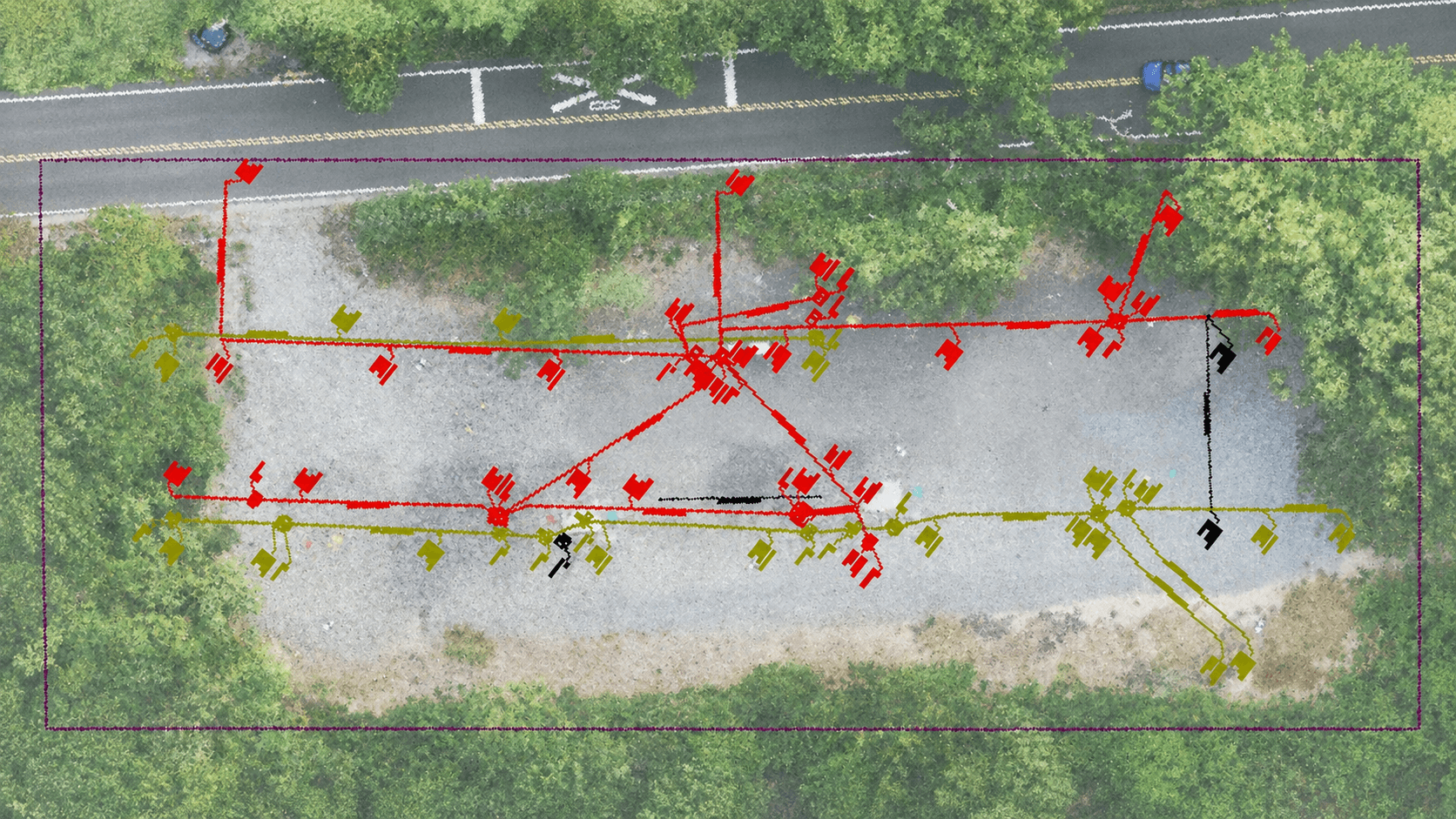
Exodigo scanned the site non-intrusively, compared findings against National Grid’s records, validated all known below-grade assets, and revealed two additional utility lines that appeared in no as-built or existing record.
THE CHALLENGE
Incomplete records beneath live gas infrastructure.
Active gas infrastructure
Any ground disturbance at the operating substation carried safety and operational risk, requiring a fully non-intrusive investigation.
Incomplete records
The available records offered no assurance they captured everything below grade.
Schematics not drawn to scale
Partial schematics showed only approximate positions of subsurface voids and structures rather than their true placement.
Exodigo's Approach
A verified map without disturbing the site.
Exodigo combined remote records review, non-intrusive multi-sensor scanning, and AI-powered analysis to turn partial documentation into a georeferenced Composite Utility Map with XYZ positioning.
ExoInfo
Remote Data Collection & Integration
Exodigo aggregated and reviewed the available records and partial schematics for the substation, flagging gaps and discrepancies to establish a baseline before fieldwork and to focus verification where the records were least reliable.
Utility Mapping
Non-Intrusive On-Site Reality Capture
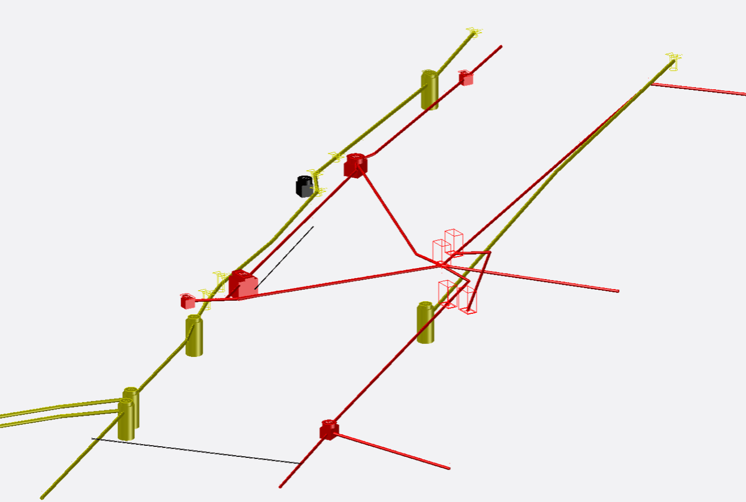
Using the ExoCart platform, Exodigo conducted multi-sensor scanning across the active substation, capturing both conductive and non-conductive utilities without any ground disturbance to live gas infrastructure. Field data was processed through Exodigo's AI into a georeferenced Composite Utility Map with XYZ positioning, aligning known and newly detected assets — and correctly placing subsurface voids and structures to scale — for direct integration into design.
Impact
Live-risk utilities found before excavation.
2 Undocumented Lines Detected
Exodigo identified two utility lines absent from all available as-builts and existing records.
100% Known Assets Validated
All known below-grade assets were confirmed and placed into one accurate underground map.
Subsurface Voids Corrected
Structures shown only approximately in schematics were placed to true scale and position.
No Ground Disturbance
The full investigation was completed non-intrusively around active gas infrastructure.
Build-Ready Subsurface Map
National Grid received a verified dataset to plan work around real underground conditions.





Exodigo found all the major below-grade assets at the Yaphank, NY site including some unknown lines that were not found in any existing documentation. This technology presents a significant opportunity for us to improve safety, reduce cost, and increase operational efficiency on our construction projects.
— David Lessard, Engineering Manager, Innovation — National Grid
Ready to build with greater certainty?
Bring us your next project. We'll show you what's beneath it.