
Case Study | Propel NY Energy
Design Confidence & Cost Certainty for a Major NY Grid Upgrade
New York Transco, in partnership with WSP, used Exodigo's non-intrusive underground mapping to accurately map and verify utilities along the Propel NY Energy transmission corridor — starting with a 2.85-acre proof of concept on Long Island, NY.
Results
Certainty you can build on.
What a 2.85-acre proof of concept revealed beneath the Propel NY corridor.
- $10Mestimated total project savings
- 159utilities mapped, incl. 82 undocumented
- 77record corrections to existing utility data
- 52%Increase in mapped utilities from undocumented assets
- ~20 InchAbandoned cast-iron main identified
- 4-MileTrench eliminated from project scope
Program Overview
An 80-mile grid upgrade, starting beneath Long Island.
Propel NY is a major transmission program adding 80 miles of underground electric lines and upgrading seven substations across downstate New York. For a segment on Long Island, New York Transco and lead engineer WSP needed a clearer understanding of underground conditions within a congested utility corridor.
Exodigo was engaged to deliver a more accurate and comprehensive view of subsurface conditions than traditional methods, beginning with a 2.85-acre proof of concept before expanding to support the broader alignment.
THE CHALLENGE
Significant uncertainty in a congested corridor.
Unresolved Records
Prior SUE work had been performed, yet record drawings and conventional locating still left open questions on utility ownership, depth, material type, routing, and operational status.
Elevated Project Risk
That uncertainty meant safety exposure for field crews, a higher likelihood of change orders and redesign, and potential schedule and budget overruns.
A Congested Right-of-Way
Work had to occur in an active suburban corridor shared by dozens of utility owners, beside an active substation, with traffic, permitting, and community disruption to manage.
EXODIGO'S APPROACH
One structured workflow, one defensible dataset.
Exodigo combined existing records, non-intrusive field scanning, utility-structure documentation, and AI-enabled data processing into a single deliverable package — moving the project from fragmented, uncertain records to one defensible dataset.
Step 01 · ExoInfo
Start with everything already known.
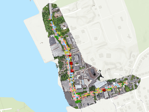
ExoInfo, Exodigo's remote data-mapping process, ingested WSP's available records, GIS and CAD data, and other existing project information to establish a baseline of known and suspected utilities — flagging record inconsistencies and prioritizing the highest-risk sites before any fieldwork began.
Step 02 · Field Investigation
Non-intrusive scanning, across an active corridor.
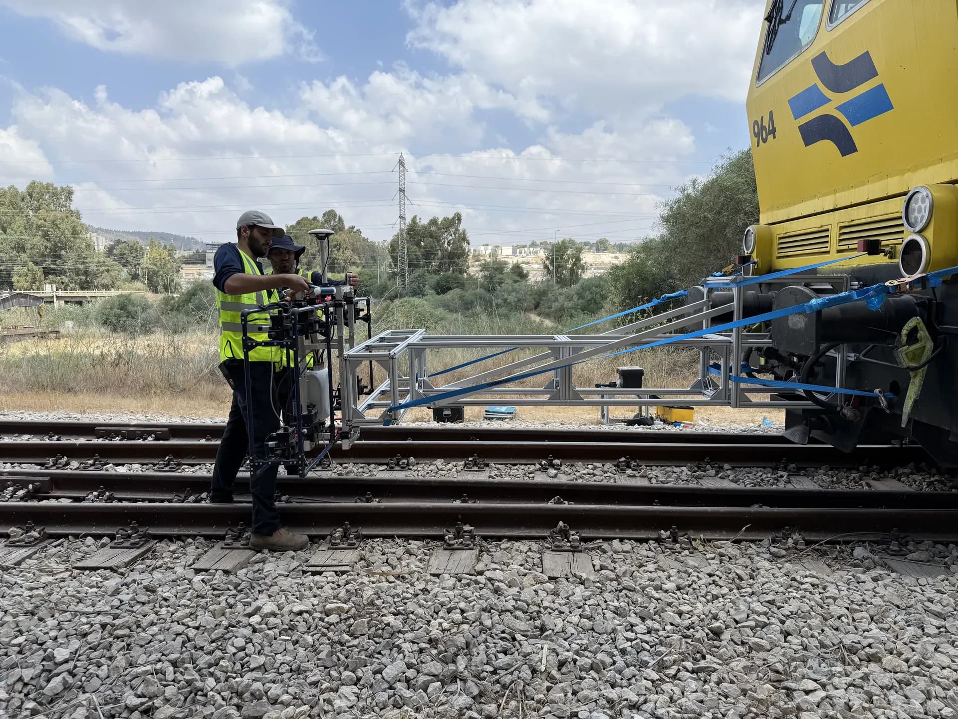
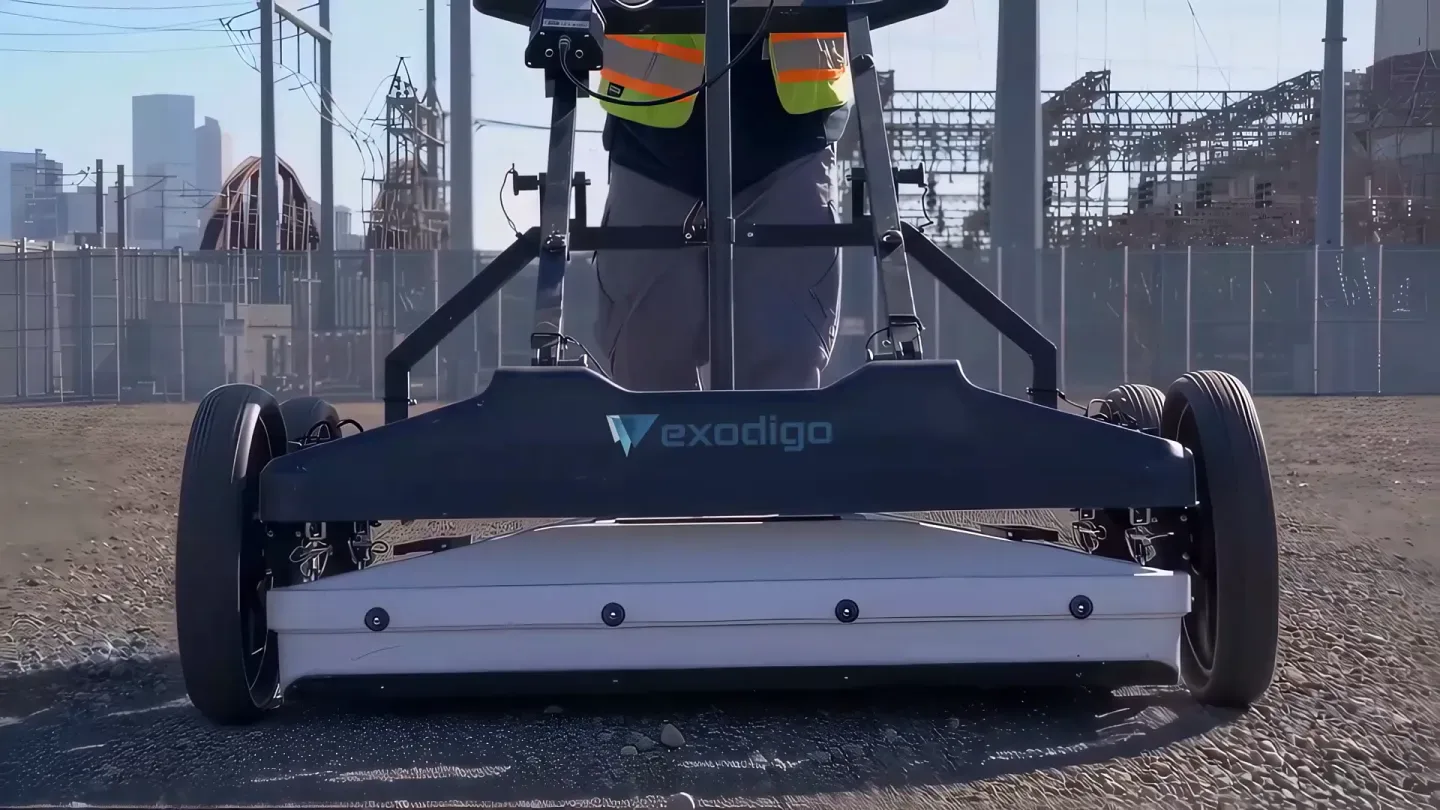
Exodigo scanned on-site using its proprietary multi-sensor platform on car- and cart-mounted rigs, with backpack units in constrained areas. Field work combined high-resolution LiDAR of utility structures, electromagnetic tracing, and supplemental geophysics — covering roughly 3,300 linear feet across two roadways without energization or excavation.
Step 03 · Engineering Maps
One defensible dataset, GIS- and CAD-ready.
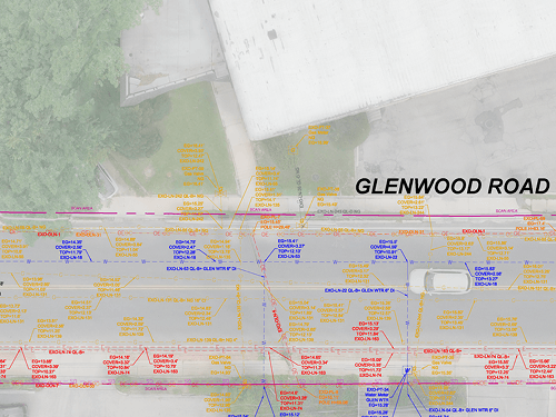
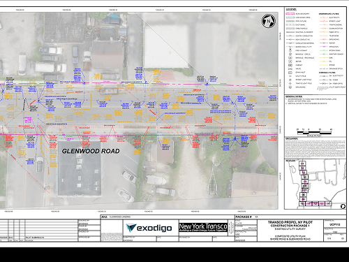
Exodigo processed the multi-sensor data through its AI-driven analytics workflow to produce 2D and 3D Composite Utility Maps — georeferenced alignments, X/Y/Z positioning, depth, utility metadata, and ASCE 38-22 quality-level classifications. The result is a single, defensible dataset rather than a patchwork of record drawings and unresolved unknowns.
THE FINDINGS
Critical gaps in the 90% design.
Corrected the Design Geometry
The 'clean corridor' between the high-voltage electric (HVE) line and water/gas was 9 feet narrower than shown, and the HVE sat outside the road shoulder — correcting an assumption that placed it 4 feet into the roadway.
Surfaced Hidden Utilities
An abandoned gas line missing from the design and two previously unknown retired gas lines were identified — confirming 14 feet of separation from the 16-inch gas line and enabling vault placement with no relocations required.
Reclassified 'Resolvable' Conflicts
Utility and gas-water conflicts previously considered resolvable were determined to require relocation based on actual, verified utility locations.
Exodigo delivered far more than utility mapping — they provided the confidence needed to make better engineering decisions. If this level of value can be achieved on a small segment, the opportunity across the full Propel NY program is substantial.
— Jesse Lubbers, Sr. Project Manager, New York Transco
The Impact
From subsurface uncertainty to engineering intelligence.
$10M in Avoided Cost
Estimated savings on the proof-of-concept corridor through avoided change orders, optimized utility coordination, and elimination of a planned 4-mile trench.
Greater Subsurface Visibility
159 utilities mapped, including 82 previously undocumented assets — among them an abandoned ~20-inch cast-iron main and two retired gas lines absent from records.
Improved Design Accuracy
77 corrections to existing utility records, including the verified location of a high-voltage electric line and a clean corridor ~9 feet narrower than the 90% design showed.
Less Intrusive Work
Reduced intrusive investigation and utility relocation, enabling confident design decisions while minimizing disruption in an active right-of-way.
Engineering-Ready Deliverables
Findings validated through client-led potholing and delivered in 2D and 3D GIS and CAD formats for seamless integration into project workflows.
Built to Scale
A standardized approach proven on a 2.85-acre pilot, ready for deployment across the broader Propel NY alignment.

Ready to build with greater certainty?
Bring us your next project. We'll show you what's beneath it.