
Case Study | National Grid - Rotterdam 69kv Substation
Subsurface Certainty for a Critical Grid Expansion
National Grid partnered with Exodigo to create a complete, engineering-grade map of underground utilities for a planned substation expansion in Rotterdam, NY, reducing design uncertainty in a complex, energized environment where existing records were unavailable.
- 20previously unknown lines identified
- 1previously "lost" service line located
- 500+ GBsubsurface data captured per acre
Project Summary
Mapping the unknown beneath a live 69kV substation.
As part of a broader push to increase grid resilience across its U.S. properties, National Grid planned to expand a 69kV substation in Rotterdam, New York. The surrounding area had no usable utility records, leaving the design team concerned about unknown buried assets as they planned the expansion footprint — a concern sharpened by a known service line field crews couldn't locate, with multiple test holes placed against existing mapping all missing it. National Grid engaged Exodigo to map underground assets inside the existing fence line and across the planned expansion, identifying risk areas to help the team avoid obstacles and strikes.
THE CHALLENGE
Hidden utilities beneath a critical grid asset.
No usable existing records
The area around the substation had no available utility records, leaving the planned expansion footprint effectively blind to what lay beneath it.
An unlocatable "lost" service line
A known service line could not be found in the field, with multiple test holes placed against existing mapping all missing it.
A GPR-hostile, energized environment
Proximity to high-voltage lines distorts Ground Penetrating Radar through electromagnetic interference — the very method conventional locators rely on — leaving traditional approaches unreliable across much of the site.
Exodigo's approach
From limited records to verified reality.
Exodigo combined available records, non-intrusive multi-sensor scanning, and AI-powered data processing to produce a complete, engineering-grade map of the subsurface — giving National Grid the confidence to design around verified underground conditions instead of incomplete records.
ExoInfo
Remote Data Collection & Integration
Exodigo began by aggregating and reviewing what limited records and as-builts existed for the site — digitizing analog formats and pulling available GIS layers to establish a baseline, and confirming early how little the existing record actually covered before fieldwork began.
Utility Mapping
Non-Intrusive On-Site Reality Capture
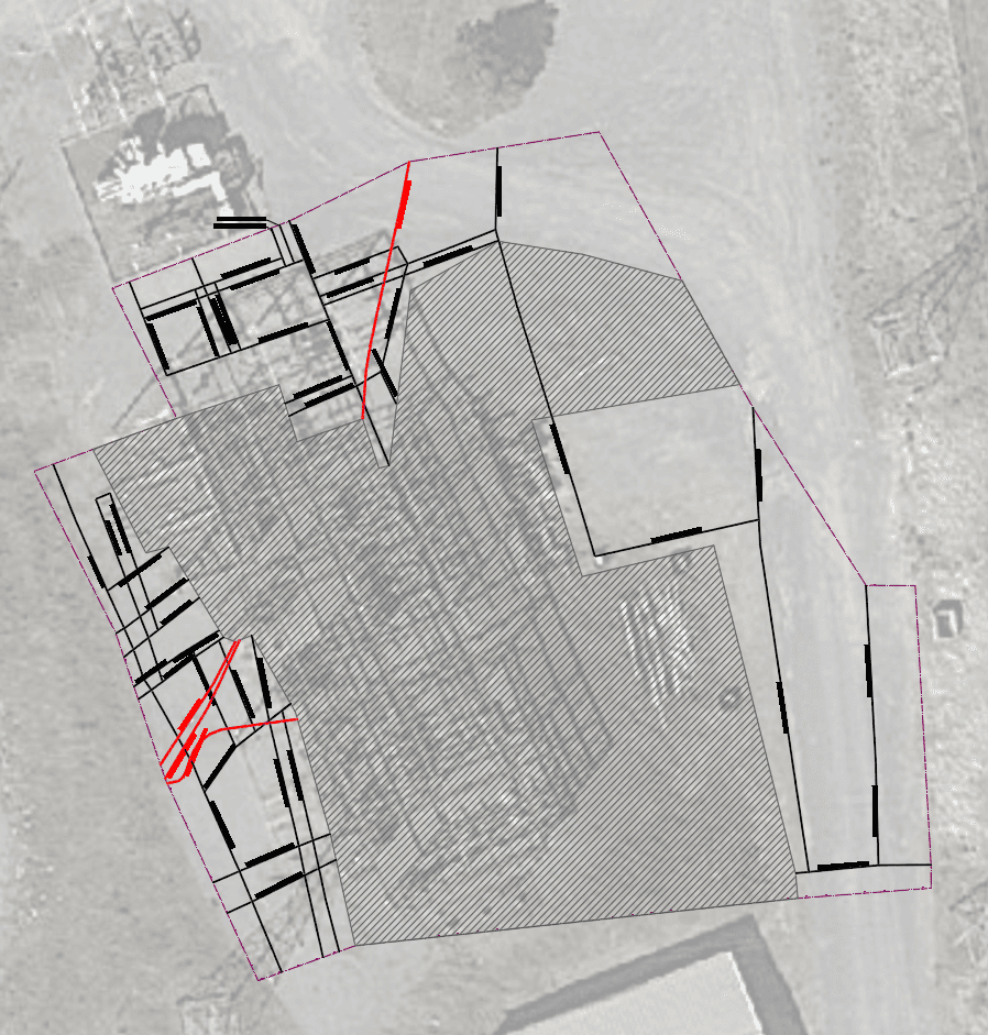
Using its ExoCart platform, Exodigo scanned every square foot of the site with an integrated multi-sensor suite — magnetic gradiometer, time- and frequency-domain electromagnetics (TDEM and FDEM), multi-channel GPR, and electromagnetic sensors — paired with centimeter-precision RTK GPS, capturing over 500 GB of data per acre. That breadth resolved subsurface geometry even adjacent to high-voltage lines, where electromagnetic interference renders GPR alone unreliable, detecting both conductive and non-conductive utilities with no ground disturbance to the energized site. Exodigo's AI processed the data into a Composite Utility Map classified to ASCE 38-22, delivered in AutoCAD (CAD), KML, PDF, and Excel formats and referenced to the State Plane New York East coordinate system.
Impact
The discoveries that enabled confident expansion
20 Unknown Utilities Identified
Located 20 previously unknown utility lines beyond the property boundary, giving the project team a complete understanding of buried infrastructure before design was finalized.
Lost Service Line Found
Successfully located a known service line that repeated test holes and existing mapping had failed to identify.
Confident Expansion Planning
Provided a verified subsurface model that allowed National Grid to finalize the expansion footprint and make informed design decisions with confidence.
Reduced Construction Risk
Identified hidden and inactive assets before construction, helping avoid costly redesigns, utility strikes, and schedule delays.
Non-Intrusive Around Live Power
Delivered complete utility mapping without disturbing the energized site, overcoming the limitations of conventional locating methods near high-voltage infrastructure.





This technology looks to be a game changer for us...[it's] like putting on prescription glasses for the first time and gaining clearer vision on what was previously limited and blurry
— Mike Roberts, Director — Substation, Civil, and D-Line Construction, NY, National Grid
Ready to build with greater certainty?
Bring us your next project. We'll show you what's beneath it.