
Case Study | Major West Coast Utility — Legacy Cross-Bore Program
Clearing Cross-Bore Risk Without Digging
A major West Coast utility partnered with Exodigo to non-intrusively map gas and sewer lines across 700 high-priority legacy sites, helping classify cross-bore risk, reduce invasive investigation, and reserve excavation for the locations that truly warranted it.
- 700high-priority sites mapped
- ~60%reduction in invasive investigation
- 33%sites classified "extremely complex"
Project Summary
A safer way to clear inaccessible cross-bore sites.
The utility faced a backlog of roughly 8,000 Unable to Access sewer sites, where conventional camera inspections could not pass due to root intrusion, flooding, or blockages. Because any one of these locations could conceal a gas line bored through a live sewer, the utility needed a scalable way to identify real cross-bore risk without defaulting to potholing or open trenching.
After a successful pilot on a single 0.5-acre parcel, Exodigo was procured to map 700 high-priority locations on a weekly delivery schedule, classifying gas-sewer crossing risk without ground disturbance.
THE CHALLENGE
The highest-risk sites were the hardest to inspect.
Inaccessible sewer lines
At UTA sites, root intrusion, flooding, and blockages blocked the sewer camera, leaving cross-bore risk unverifiable by conventional means.
Sparse or absent records
The legacy sites carried little reliable documentation of what was buried or where.
Intrusive, costly fallback
Without a camera pass, confirming a cross-bore meant potholing or, as a last resort, open trenching — slow, expensive, and disruptive on dense residential streets.
Difficult subsurface conditions
Many assets had no tracer wire, P-traps were inaccessible, depth ratios were low, and small-diameter plastic pipe sat below what conventional locating reliably detects.
Exodigo's Approach
From inaccessible sewers to ranked cross-bore risk.
Exodigo combined remote records intelligence, non-intrusive multi-sensor scanning, and specialized R&D to locate gas and sewer infrastructure, resolve line geometry, and classify cross-bore risk across the utility’s hardest-to-clear sites.
ExoInfo
Remote Data Collection & Integration
Exodigo aggregated and digitized the available records — as-builts, plans, and GIS layers — and combined them with high-resolution aerial and satellite imagery to establish a baseline for each site and flag where documentation was thin, conflicting, or absent before fieldwork began.
Utility Mapping
Non-Intrusive On-Site Reality Capture
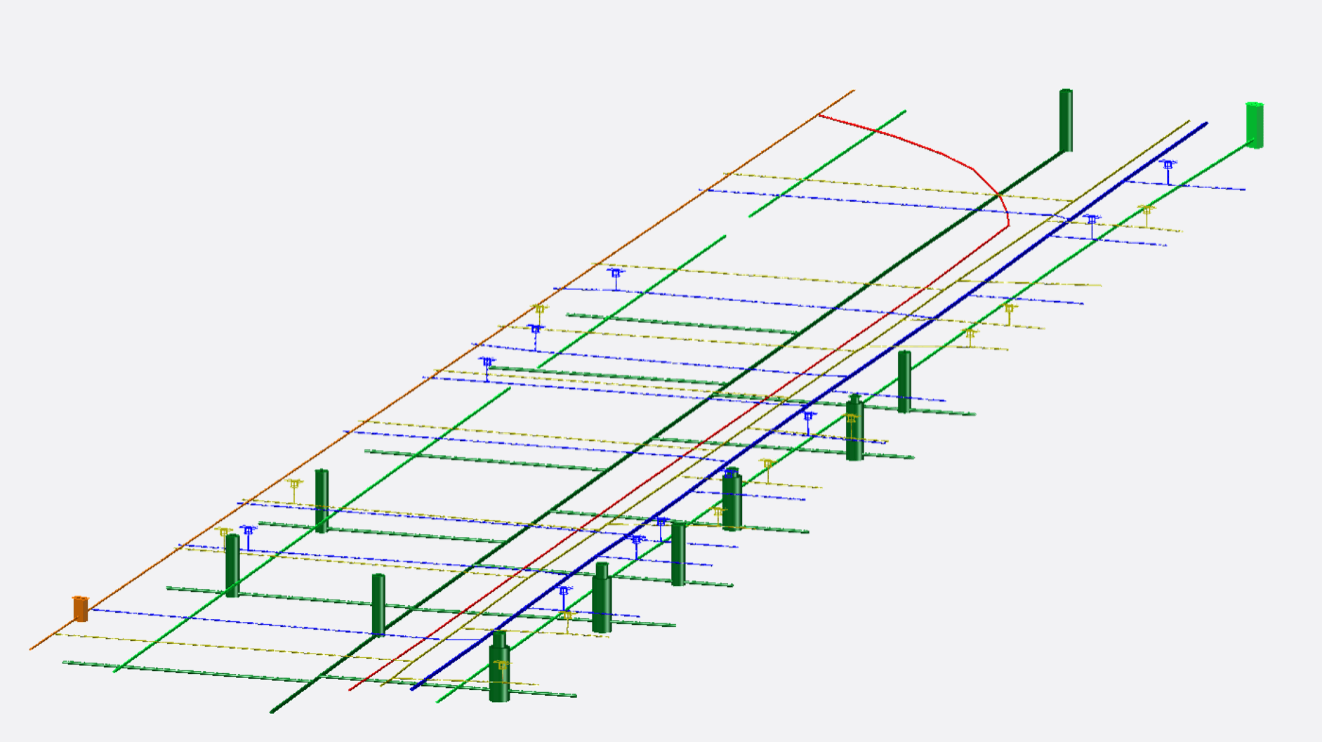
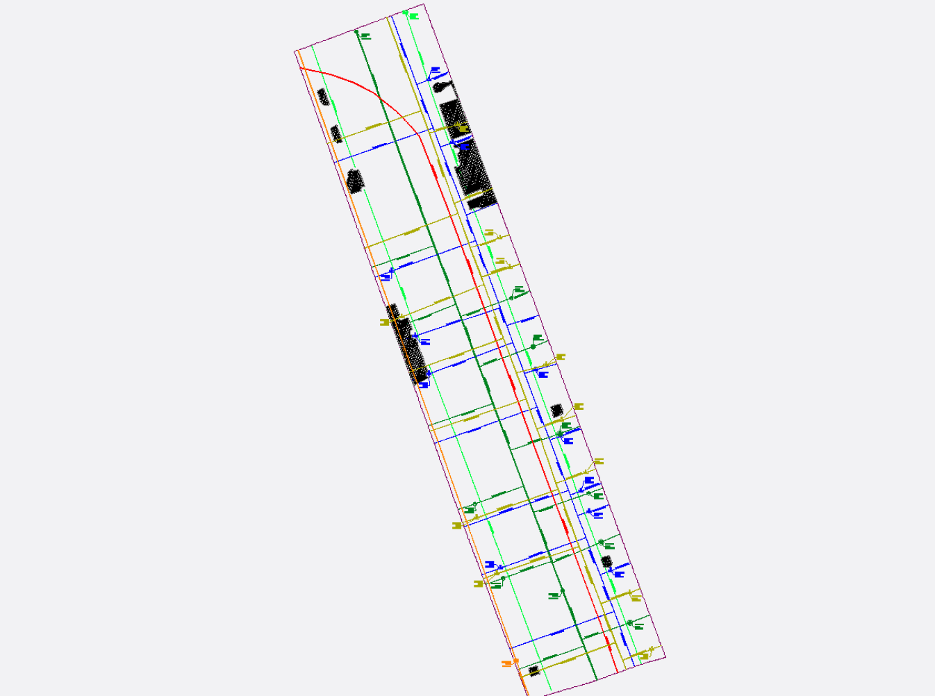
Using the ExoCart platform, Exodigo scanned each site with an integrated multi-sensor suite — GPR, electromagnetic, and magnetic sensing — capturing centimeter-precision georeferenced data across the residential right-of-way with no ground disturbance. To resolve the program's hardest sites, Exodigo invested in R&D specific to this work: adding seismic depth sensing and tracing techniques to recover non-conductive and small-diameter plastic pipe that conventional locating could not detect. Detected gas and sewer lines were positioned and classified per ASCE 38-22, and Exodigo delivered Composite Utility Maps in the utility's proprietary format, showing horizontal and vertical positions and the proximity clearance between crossing lines.
Impact
The separation that made excavation selective.
Real Risks Separated From Harmless Crossings
At the pilot site, Exodigo found five gas-sewer crossings, but only two fell within the five-foot vertical separation that flagged cross-bore risk.
~60% Less Invasive Investigation
By distinguishing risky crossings from safe separations, Exodigo helped reserve excavation for the lines that truly warranted it.
39% Projected Cost Reduction
Scaled across the backlog, the approach projected significantly lower program costs compared with conventional invasive investigation.
24% Projected Time Reduction
Non-intrusive classification helped the utility move through UTA sites faster than camera, potholing, and trenching workflows.
Safer Residential Workflows
The program reduced unnecessary disruption on dense residential streets while helping the utility prioritize potential safety exposures.


Ready to build with greater certainty?
Bring us your next project. We'll show you what's beneath it.