
Case Study | Granite Construction & Caltrans — I-70 Widening
Replacing Change Orders with Confidence
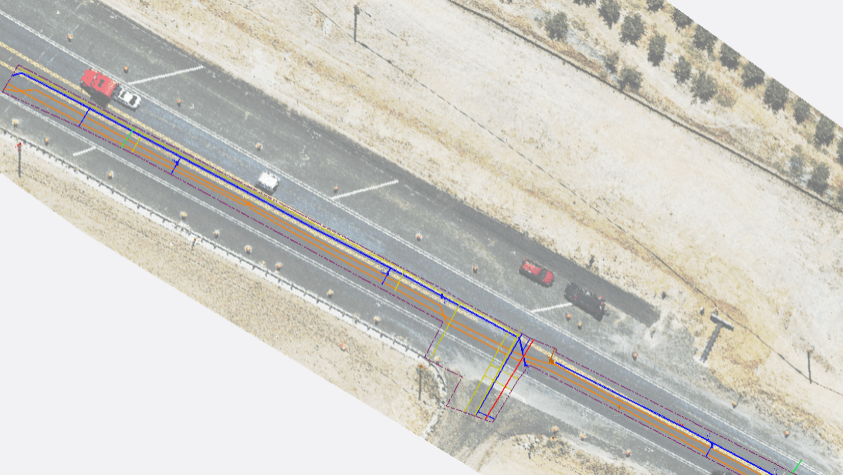
Granite Construction and Caltrans brought in Exodigo after repeated utility strikes, change orders, and failed conventional verification on an active I-70 widening project near Marysville, CA. In one high-risk easement, Exodigo’s non-intrusive scan mapped 28 utilities — compared with only 11 identified in existing records and prior surveys.
- 28utilities mapped (vs. 11 in existing records)
- 2.5xmore utilities than identified in prior surveys
- QL-BASCE 38-22 quality level assigned to all lines
Project Summary
Mapping what conventional methods kept missing.
During the I-70 widening project near Marysville, CA, Granite Construction experienced repeated utility strikes mid-construction. Despite multiple traditional subsurface surveys, potholing, and trenching, the project generated change order after change order driven by utility strikes. Exodigo was brought in to scan one high-risk easement and deliver a single, verified picture of what was actually underground to prevent more strikes and delays.
THE CHALLENGE
Repeated utility strikes in an active highway corridor.
Traditional methods had already failed
Prior surveys, potholing, and trenching had been run and re-run, yet utility strikes continued.
Incomplete subsurface records
Existing records captured only 11 of the 28 utilities ultimately found, leaving most buried assets unaccounted for.
Change orders and rework
With no reliable subsurface basis to build against, the project faced continued rework, delays, and cost exposure.
High-risk active construction zone
Granite and Caltrans needed clarity without more disruptive, inconclusive digging in an active highway widening corridor.
Exodigo's Approach
From strike risk to verified utility intelligence.
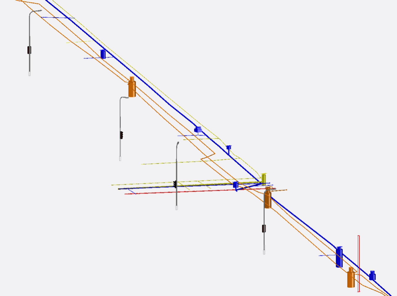
Exodigo combined remote records review, non-intrusive multi-sensor scanning, and AI-powered processing to produce a Composite Utility Map with XYZ positioning and ASCE 38-22 quality levels — giving Granite and Caltrans a defensible dataset to redesign and build against.
ExoInfo
Remote Data Collection & Integration
Exodigo aggregated and reviewed the available records and prior survey data — partial and incomplete — flagging gaps and discrepancies to establish a baseline for targeted, non-intrusive investigation.
Utility Mapping
Non-Intrusive On-Site Reality Capture
Using the ExoCart platform with integrated GPR, electromagnetic, magnetic, and metal detection sensors, Exodigo conducted multi-sensor scanning across a 0.49-acre easement, detecting both conductive and non-conductive utilities without any ground disturbance. Field data was processed through Exodigo's AI into a Composite Utility Map with XYZ positioning, with all lines classified to ASCE 38-22. Deliverables were provided as an ArcGIS map package/GIS Online (ESRI), Civil 3D, and SHP files, referenced to the California State Plane Coordinate System.
Impact
The certainty that kept construction moving.
28 Utilities Mapped
Exodigo identified 28 utilities across the easement, compared with only 11 captured in existing records and prior surveys.
17 Unaccounted-For Lines Found
Each previously missed line represented a potential strike, shutdown, redesign, or emergency change order.
2.5x More Utility Intelligence
The scan revealed more than twice as many utilities as conventional methods had identified.
Verified Basis for Redesign
Granite and Caltrans gained a complete, engineering-grade dataset to redesign and build against with confidence.
Reduced Active-Corridor Risk
By resolving buried utilities non-intrusively, Exodigo helped replace reactive field discovery with proactive subsurface certainty.


The business case for multi-sensor fusion and AI for subsurface discovery is clear. Our underground utilities account for 50% of all delay-related change order dollars; that’s an enormous percentage, so reducing utility strikes represents savings of millions of dollars a year.
— Aaron Chamberlin, Senior Innovation Engineer, Caltrans
Ready to build with greater certainty?
Bring us your next project. We'll show you what's beneath it.